
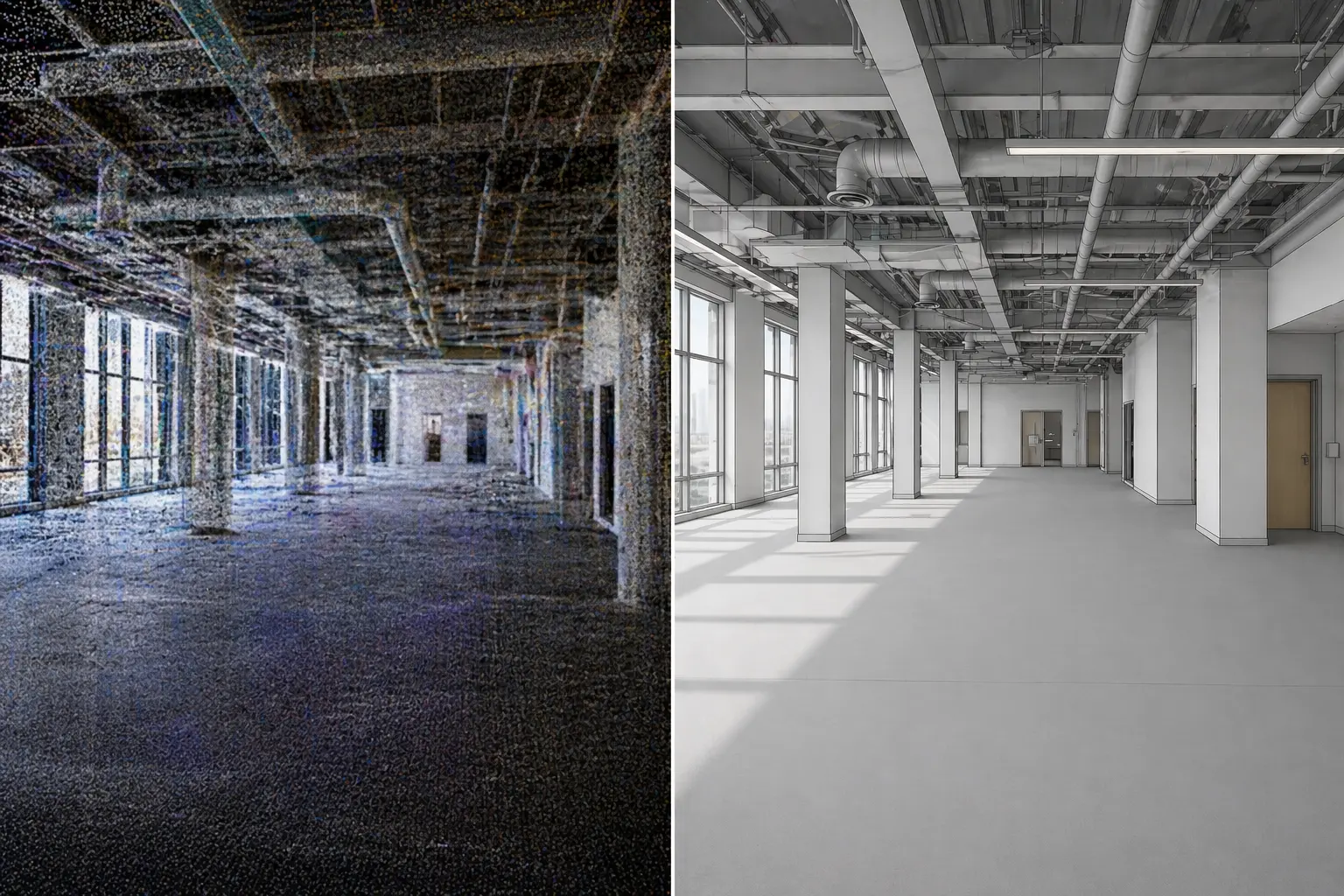
If you search for 3D scanning or reality capture near Myrtle Beach, you will find national networks, Matterport-style tour providers, and local capture teams. The useful question is not which brand name is louder. It is what you need the deliverable to do—and whether the partner on site can produce it.
Estate360 provides as-built 3D laser scanning and LiDAR reality capture for renovation, documentation, and existing-conditions projects throughout Myrtle Beach and the Grand Strand. This article explains the process, who it is for, what you typically receive, and when booking a local capture partner makes more sense than a remote network handoff.
What “3D reality capture” means on our jobs
Reality capture digitally documents physical spaces with laser scanning and imaging. On Estate360 projects that usually means:
- •On-site LiDAR laser scanning for dense spatial geometry
- •A high-density point cloud as the measurable backbone
- •Dimensional floor plans and CAD-ready reference when scoped
- •Visual walkthrough documentation for remote stakeholders
- •A clear scope record of what was captured and delivered
The goal is a shared existing-conditions package—not a buzzword demo. For how tours differ from laser as-builts, see Matterport Tour vs Laser Scan As-Builts. For plans specifically, see Dimensional Floor Plans from Reality Capture.
How a typical capture runs
Every site is different, but the workflow is consistent enough to plan around:
- Scope — what areas matter, who will use the files (owner, architect, GC), and which outputs you need (point cloud, plans, walkthrough, CAD-ready reference).
- On-site capture — laser scanning and visual documentation of the agreed areas, with access and safety constraints noted.
- Processing — turning field data into the deliverables you scoped.
- Handoff — files and a short record of date, coverage, and what’s included so the next stakeholder is not guessing.
On Grand Strand coastal renovations and commercial TI, the usual handoff is a point cloud and dimensional floor plans for design or construction, plus a walkthrough for managers and vendors who will not be on site every week.
Who this is for
Local reality capture is a fit when:
- •Architects and designers need measured existing conditions before renovation drawings
- •Contractors need clearances and layout truth before bid or build
- •Owners and managers need documentation beyond a photo dump (Property Condition Documentation Beyond Photos)
- •Hospitality and STR teams need renovation or portfolio baselines (Reality Capture for Hotels and Vacation Rentals)
- •Developers and larger renovations need interior geometry—and sometimes site context later in the series
Broader renovation context: As-Built 3D Scanning for Renovations.
Local partner vs. national network
National 3DVR / Matterport-network options can work well when you mainly need a shareable walkthrough and a standardized viewer. They are a weaker fit when you need a local crew who can scope laser as-builts, dimensional plans, and CAD-ready reference for a Grand Strand renovation—and stand behind the field capture when access, coastal buildings, or phased work get messy.
Book local when:
- •Design or construction decisions hang on measured geometry
- •You want one accountable partner for scan + plans + walkthrough
- •Site access, timing, or phased renovations need someone who can return to the property
- •You care more about file usefulness than a national brand page
A network tour is often enough for visibility-only jobs. Ask what file you get, who uses it, and whether it supports measurement—or only viewing.
What you typically receive
Depending on scope:
- •LiDAR point cloud
- •Dimensional floor plans
- •CAD-ready reference
- •Visual walkthrough
- •Scope/date/coverage notes with the deliverable checklist
Honest limits: capture does not replace a licensed survey when one is required, and it cannot invent conditions that were inaccessible on site.
Why local field capture matters on the Grand Strand
Estate360 is based in Myrtle Beach and works projects across the Grand Strand—including nearby coastal and inland markets when the job calls for it. Coastal stock, aging buildings, and renovation-driven work are a regular part of what we see. Capture can be one-time or timed to phases.
Get started
If you need 3D reality capture for a Myrtle Beach or Grand Strand project—and you want process and deliverables scoped to the decision you are making—reach out at sales@estate360.us or through estate360.us/contact. Call 843-306-8063.