
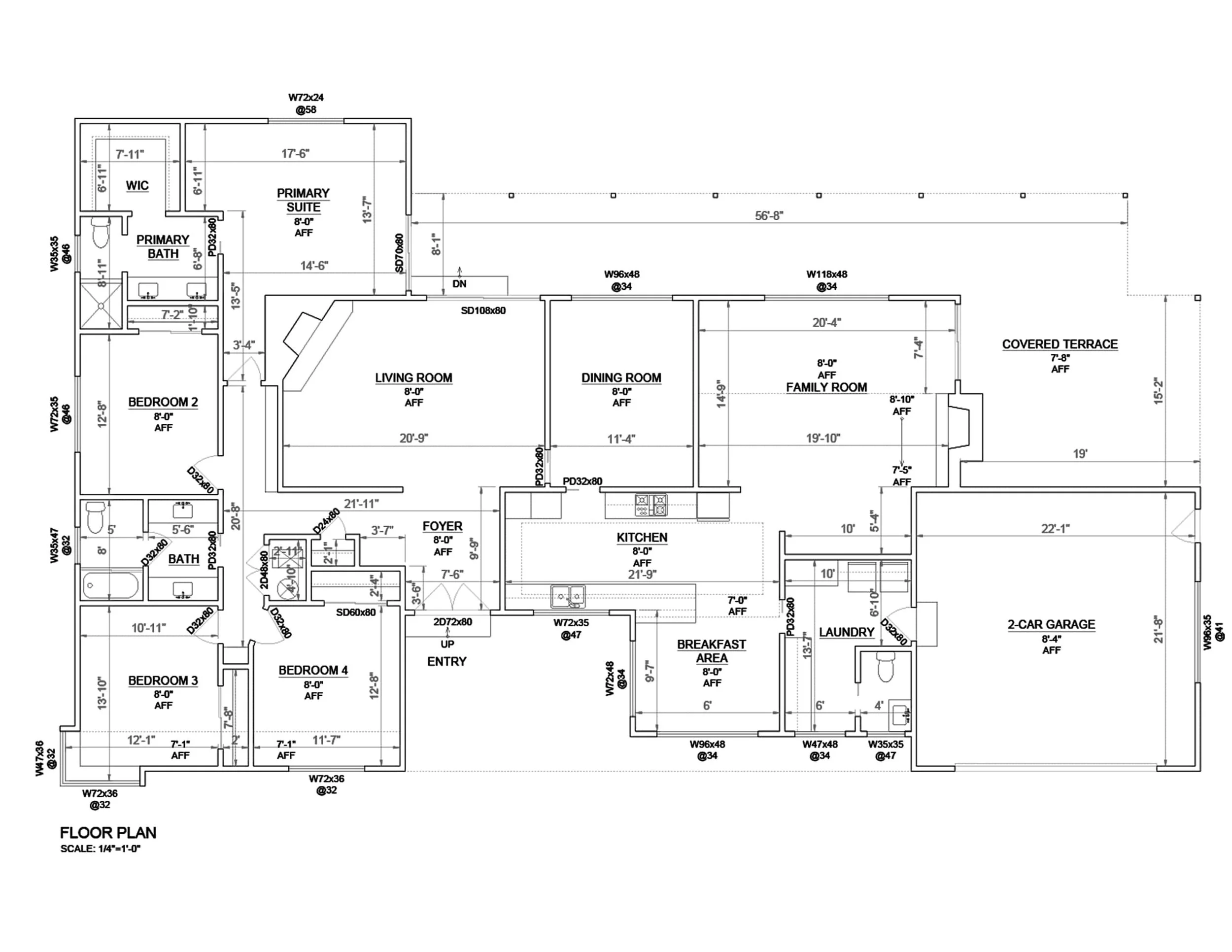
Floor plans show up in a lot of places: marketing packages, leasing kits, furniture layouts, renovation drawings. Not all of them are built the same way—or meant for the same job.
For design and construction work on the Myrtle Beach Grand Strand, the question is usually not whether you have a clean plan graphic. It is whether the plan is grounded in measured existing conditions the architect, interior designer, or GC can trust before they order millwork, lock clearances, or hang a renovation on outdated drawings.
Estate360 provides as-built 3D laser scanning and LiDAR reality capture that supports dimensional floor plans for renovation, retrofit, and existing-conditions projects throughout Myrtle Beach and the surrounding Grand Strand. This post is about design- and construction-ready plans—not simplified graphics made only for marketing or leasing.
What “dimensional” floor plans mean here
A dimensional floor plan from reality capture starts with laser scanning the space as it exists. From that geometry, teams can produce plans that reflect real room sizes, wall locations, and layout constraints—not a sketched approximation from a quick walkthrough.
Typical Estate360 deliverables around this workflow include:
- •High-density point cloud as the measurable source
- •Dimensional floor plans grounded in the scan
- •CAD-ready reference when the design team needs it
- •Visual walkthrough documentation for stakeholders who need to see the space, not only the plan
The plan is one output. The point cloud underneath it is what makes the dimensions defensible when someone asks, “where did these numbers come from?”
Design and construction use vs. marketing or leasing plans
Marketing and leasing plans are often enough for a buyer, guest, or tenant to understand room flow. They are usually the wrong primary deliverable when:
- •An architect is preparing renovation or TI drawings
- •A contractor needs clearances before ordering fixtures or millwork
- •A designer is laying out kitchens, baths, or FF&E against real walls
- •A GC is coordinating trades around existing conditions that drawings do not match
On Grand Strand coastal renovations and commercial tenant improvements, the usual handoff is a point cloud plus dimensional floor plans the design or construction team can work from—sometimes with a walkthrough for owners who will not be on site every week. That is a different product than a simplified plan graphic made for a brochure or listing packet.
When a scan-backed plan pays off
Dimensional plans from reality capture earn their keep when existing drawings are missing, outdated, or clearly wrong—and when guessing wrong is expensive.
Common triggers:
- •Pre-design existing conditions before renovation scope locks
- •Checking a door swing or millwork run against real clearances before the order goes in—so the crew is not discovering a conflict after the truck shows up
- •Aligning multiple stakeholders on one measured layout
- •Reducing repeat site visits for “can you confirm this wall?” questions
- •Giving remote designers a plan they can trust without another Grand Strand trip
Floor plans often sit inside a broader condition-documentation package. See Property Condition Documentation Beyond Photos. For renovation context, see As-Built 3D Scanning for Renovations. If you are still deciding between a visual tour and laser as-builts, see Matterport Tour vs Laser Scan As-Builts.
What you get vs. what you do not
You get: measured layout documentation tied to capture of the real space; a shared reference for design and construction; optional CAD-ready files when scoped.
You do not get (unless separately scoped): a substitute for a licensed survey when one is legally required; a guarantee that every hidden condition is known; a marketing-only plan with no geometric backbone.
Honest scoping matters. If the only need is a simple graphic for leasing, say so. If the need is design-ready existing conditions, scope laser capture and dimensional plans—not a tour-only package.
Who uses these plans on the Grand Strand
Estate360 works with architects, interior designers, general contractors, developers, and property owners documenting spaces before upgrades across Myrtle Beach, North Myrtle Beach, Surfside, Conway, and nearby markets. Coastal stock, aging buildings, and renovation-driven work are a regular part of the local mix.
Capture can be a one-time existing-conditions job or timed to phased renovations when layouts change.
Get started
If you need dimensional floor plans for a Myrtle Beach or Grand Strand project—plans built for design and construction, not a marketing graphic alone—Estate360 can help with professional 3D laser scanning and LiDAR reality capture.
Reach out at sales@estate360.us or through estate360.us/contact. Call 843-306-8063.